Kelp Research and Monitoring in the Sanctuary
National Marine Sanctuaries provide a unique opportunity to engage academic scientists with the federal government to work together to understand and restore nationally significant marine habitats. Research and monitoring of kelp provides critical information to inform management strategies to protect resilient kelp forests and restore degraded kelp forests. Mapping kelp canopy with uncrewed aerial systems (UAS; commonly referred to as "drones") and engaging in subtidal research provides important information to inform restoration and management efforts. Greater Farallones National Marine Sanctuary is focused on targeting research in areas where there is kelp resilience, where restoration is needed and possible, and where there is a need for more information. The Greater Farallones Association has captured the Sanctuary Advisory Council's research recommendations in the Sonoma-Mendocino Bull Kelp Restoration Plan.
Mapping and Monitoring to Inform Strategic Restoration
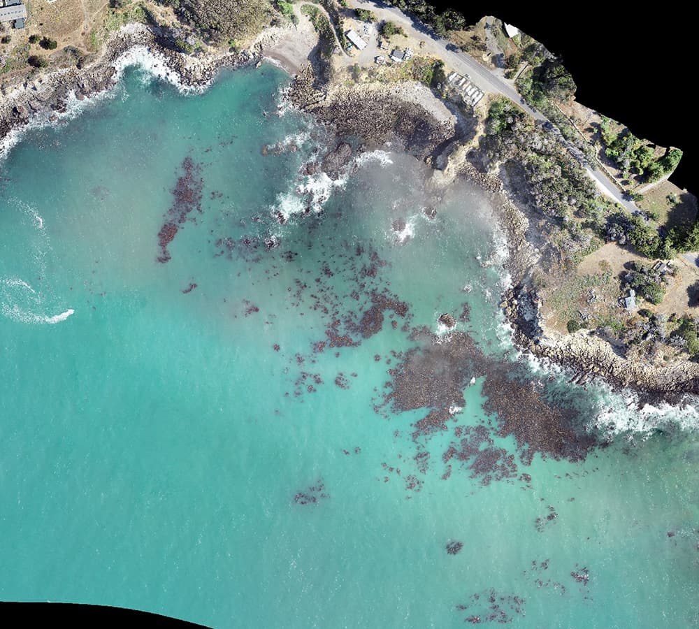
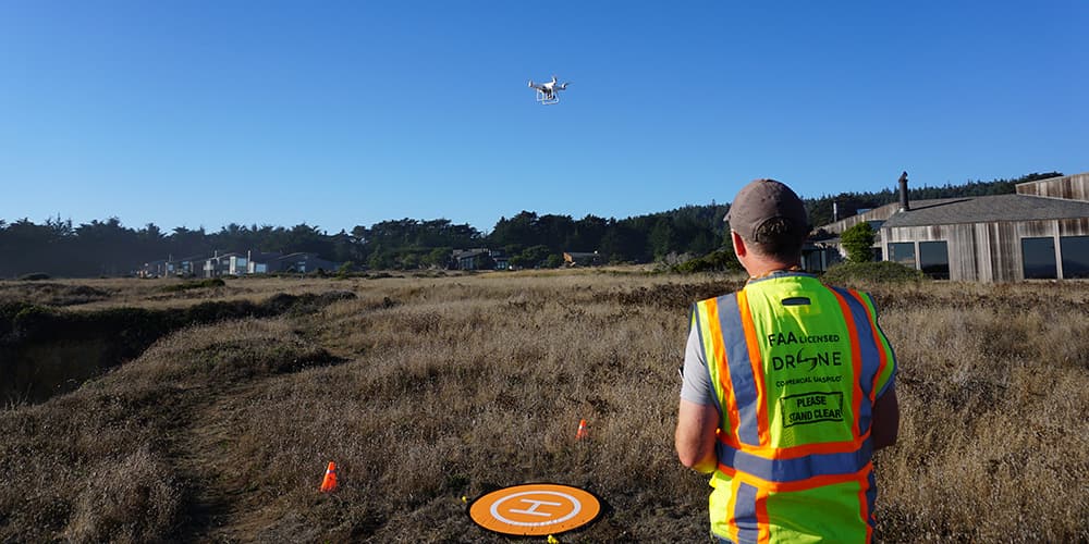
In collaboration with the National Marine Sanctuary Foundation, Greater Farallones Association, and the Nature Conservancy, sanctuary researchers launched one of the largest UAS marine mapping projects in California, mapping kelp canopy in the waters of Greater Farallones National Marine Sanctuary. The goal of the program is to obtain very high-resolution (VHR) imagery (~2-5 cm) of kelp canopy at priority sites using UAS to understand the spatial dynamics of kelp loss and resilience, and inform strategic restoration efforts.
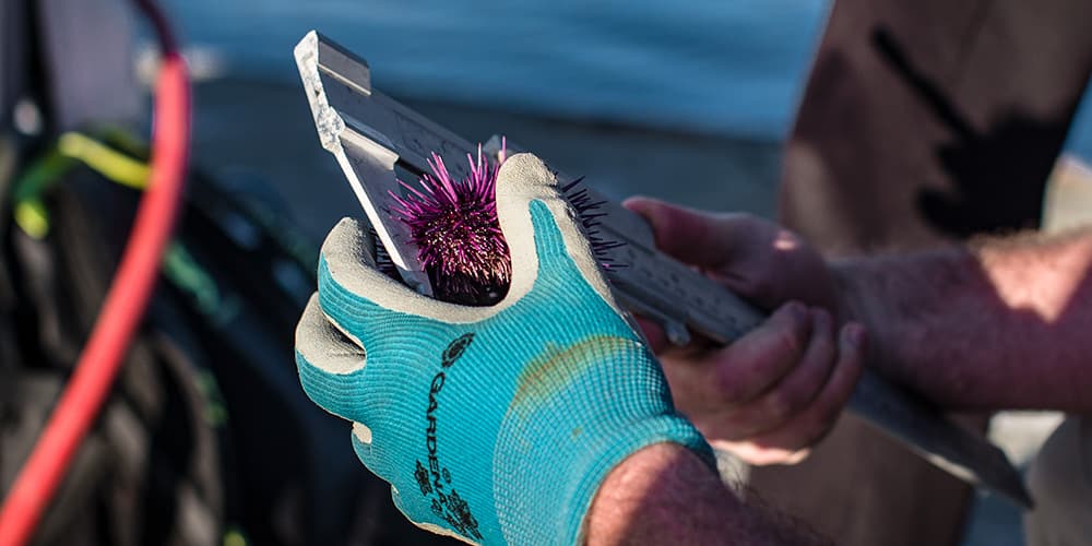
The National Marine Sanctuary Foundation supported the development of a report outlining mapping and monitoring resources for the various remote sensing and aerial imaging platforms for West Coast National Marine Sanctuaries that provides recommendations to use remote sensing platforms to address a number of management issues, including kelp forest restoration and monitoring. The sanctuary collaborates with the California Department of Fish and Wildlife, other California sanctuaries and the Greater Farallones Association annually to conduct research on kelp forests and assess kelp restoration sites via scuba and UAS aboard the R/V Fulmar and from the shore.
Research Partnerships
National marine sanctuaries provide a unique opportunity to engage academic scientists with the federal government to work together to understand and restore nationally significant marine habitat.
Planning for kelp recovery and protecting resilient kelp would not be possible without the active involvement and participation from people throughout the state of California. By restoring bull kelp in Greater Farallones National Marine Sanctuary, we can change the trajectory of an entire ecosystem from urchin barrens back to kelp forests.
For more information
Farallones Restoration Planning
Remote Sensing Tools for Mapping and Monitoring Kelp Forests along the West Coast